Public funding
This project, with file number IN852A 2018/14, was subsidized in the Conecta Peme 2018 call by the Galician Innovation Agency, with the support of the Ministry of Economy, Employment and Industry. Co-financed by European Union FEDER funds.

Project description
The project addresses four relevant and current research challenges in which it is intended to make contributions and develop technology that advances the state of the art today; who knows:
- Smart Planning.
- Semantic Labeling of Trajectories.
- Efficient Representation and Storage of Trajectories.
- Automated Software Development.
The scientific-technological advances that are intended to be made in these four research challenges constitute the 4 research or transversal objectives of the project.
The results of the first three research objectives will allow the creation of the different software modules that would need an advanced Mobile Worker Management (GTM) application to enable the planning, monitoring and storage and operation of the daily work of each mobile worker. Thus, with these modules, three prototypes of GTM applications will be implemented, each adapted to the needs of one of the three not TIC (INFORMATION AND COMMUNICATIONS TECHNOLOGIES) companies in the consortium. These three prototypes, which will have a common software architecture, constitute the 3 technological or vertical objectives of the project and will serve to test and validate the technologies resulting from the first three research challenges.
On the other hand, its software modules, properly encapsulated, will be used to create a fourth prototype for the consortium’s TIC company, but instead of being a GTM application, it will be a tool for generating GTM applications, which we will call HGAGTM and which constitutes the ultimate goal of the project. The creation of HGAGTM will not only require the previously created components, the result of the first three research challenges, and tested through their use in the three prototypes of GTM applications, but will also obviously need to address the fourth research challenge.
Participating Entities
Four companies participate in the GEMA project, GESUGA S.L., TAPREGA S.L., MAYORES S.L. and ENXENIO S.L. and the TIC Technology Center (CITIC) of the University of A Coruña.
CITIC, subcontracted by the four participating companies, is responsible for all research work and directs development tasks. More information on the four companies in the consortium and on the work of CITIC for this project can be found on the corresponding websites:
- A0 Mayores Servicios Sociales, S.L. (https://mayores.es/proyecto-gema/)
- Taprega Prevención de Riesgos, S.L. (https://www.taprega.com/proyectogema/)
- GESUGA S.L. (https://www.gesuga.com/proyecto-gema/)
- Enxenio S.L. (https://www.enxenio.es/enxeniolabs/gema-gestion-de-la-movilidad/)
- Technological Center of the University of A Coruña (CITIC).
Project results
As already indicated, the research work was to result in 3 prototypes of mobile worker management applications for each of the three non-technology companies in the consortium. Those prototypes constituted the technological objectives of the project.
The general research results are described on the CITIC website, as the researchers at that center were responsible for them. Similarly, the website of each company describes the prototype made for it. Therefore, here we only describe the work done by and for GESUGA.
It should be noted that the pandemic with confinement first and contact restrictions after which led the IT staff to telecommute, have hampered the development of the work, but even despite these delays we have achieved all project objectives and have developed all applications until its current prototype phase which after a process of field testing and consequent adjustments will be fully functional in the future. The main achievements are:
1. Results in intelligent trajectory planning.
CITIC researchers have explored the use of different route planning algorithms by comparing their results and optimizing their execution parameters in order to fine-tune an optimal and appropriate route planning tool to our needs.
To test and compare the different algorithms and compare them with our current manual planning, a “simulator” was designed and implemented that allows you to track the result of each algorithm by running a one-week route planning simulation. The simulator receives one-week alerts simulating the time (hour) at which each alert is received. The simulator does the daily planning statically with the alerts received up to the time of generation of the daily planning plus the pending animals from previous days. Then, for the alerts received throughout the day the simulator makes a dynamic modification of the previous static schedule to include those alerts in the routes already planned.
To ensure that trucks have capacity to include these new daily collection requests (notices of collections in livestock farms), the initial static planning for each day is calculated by including non-actual “theoretical” collection requests, which correspond to points with high usual concentration of collection requests. These points with a high concentration of collection requests, will be modified according to the passage of time, automatically following the reality of the concentration of collection requests in the different areas of Galicia.
Now that we have the simulator, it will be possible to compare the number of kilometers and animals collected in any past week with the kilometers we would have traveled using automatic planning with different parameters.

2. Results in automatic detection of activities using a mobile application
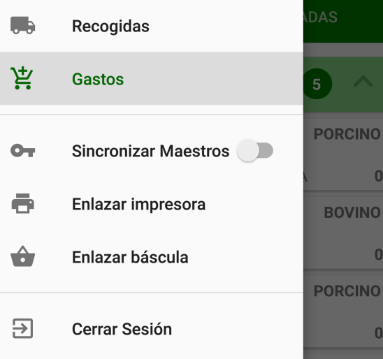
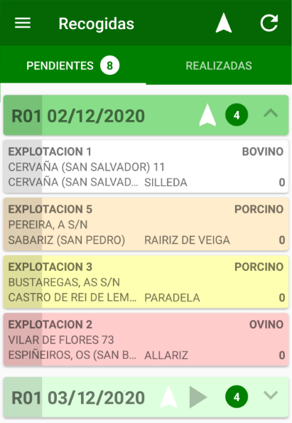
On the one hand in GESUGA has developed an advanced android application that serves as an agenda of work to be done by each driver. In that application the driver receives the collection requests to be collected. That application is fully integrated into daily work.


On the other hand CITIC has developed a mobile application to detect the type of movement that makes the smartphone. That app uses an automatic sorting algorithm, which analyzes the cell phone’s sensors (accelerometer, and GPS) and deduces the type of motion it makes. We consider four types of movement: driving, walking, standing, and idling. In addition, this application sends the GPS positions of the device, which allows you to not only know the position of each truck in real time but also use that data for analysis and detection of the activity being performed. That is to say, the information of the GPS but the one of the type of movement already detected in the own mobile, are the entrance to an algorithm that crosses a decision tree that allows to finally associate to each moment of the trajectory of a truck one of the following activity labels:
- Smooth driving on a planned route
- Slow driving on a planned route
- Smooth driving off planned route
- Slow driving off the planned route
- Driving rest
- Unidentified short stop (less than 15 minutes)
- Collection of the order
- Work at GESUGA facilities
- Unidentified activity
- No activity
This application is currently in the field test phase in some trucks before being installed on mobile phones that all drivers use to receive the collection requests.

3. Efficient representation and storage of trajectories
We have designed and implemented an application that accesses the historical information of the trajectories of all trucks at any date in the past and facilitates the exploitation of information about the routes performed and the activities and time spent on each of them.
That fully functional application is a prototype that currently uses a PostGis spatial database for efficient storage of trajectory history. However CITIC researchers are designing a compact data structure that will make it easier to store all the routes and activities done by each driver at each instant in a compressed way so that it will be possible to store all that information in much less space in the future. That structure is already implemented and is being evaluated experimentally before using it to replace the current spatial database.
Once the mobile application has been tested and adjusted as indicated by field testing and the compact data structure has replaced the spatial route database, we will include the historical route exploitation and activity interface in our application.
Results of the dissemination of the project
https://codigocero.com/O-CITIC-presenta-o-proxecto-GEMA-ante-o-tecido-innovador-galego
https://codigocero.com/Presentase-no-CITIC-o-proxecto-GEMA-financiado-por-GAIN-a-traves-de-Conecta
https://cadenaser.com/emisora/2019/07/29/radio_coruna/1564417988_053616
Presentation of project results
The results of proyect were presented at two dissemination events held at CITIC:
1) Results disclosure session:
– Announcement: https://citic.udc.es/gl/divulgacion-de-resultados-do-proxecto-gema/
– Video of the session: https://www.youtube.com/watch?v=TKyqF33DSJU&t=2s
2) Technical session of results:
– Announcement: https://citic.udc.es/gl/sesion-academica-de-presentacion-de-resultados-do-proxecto-gema/
– Video of the session: https://youtu.be/JQ3E6IXLdtE?t=5839
